What’s better than that first bright, warm morning in spring or maybe you prefer when the leaves are just starting to change on the first, crisp fall day. Possibly, you’re someone who loves to see the full moon rise, large and low on the horizon. If you’re from the Lowcountry, it’s likely that your favorite is gazing out over a flooded saltmarsh at high tide.
It’s truly a natural wonder. In a six-hour period, the tidal creeks change from nearly dry to a flooded oasis for plants and animals! However, sometimes the water flooding the saltmarsh doesn’t stay within its boundaries, impacting our day to day. Although this is due to many factors, the overarching reason is climate change.
Don’t Get Tongue-Tide
On the east coast of the United States, we have two high tides and two low tides per day, averaging about 5.5 feet in tidal range (which is the difference between the low tide mark to the high tide mark). A few times per year, we experience higher than usual high tides, which are called spring tides. And furthermore, there are another few times per year where these spring tides are extra high, known as king tides.
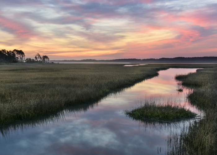
 Saltmarsh nearing low tide in Mt. Pleasant, South Carolina
King tides occur when the moon, which affects our daily tidal cycle, is in its closest position to Earth concurrently with a spring tide. This causes the moon to have its strongest gravitational pull on Earth, causing king tides of seven feet or more — that’s the length of a giraffe’s neck, a standard pool table or a king size mattress!
More Than Just a Nuisance
While king tides have always occurred, they have become more of an issue in recent years. Rising sea levels have increased the frequency and impact of king tides interrupting our daily lives, including here in Charleston. Water may bubble up through storm drains, flow down streets or flood businesses and homes, even on a sunny day!
 Water flooding a storm drain in downtown Charleston
Our commutes are disrupted, property is lost and we begin to notice saltmarsh grasses growing where they never have before. These are all issues that we now face on a regular basis, and some communities in the Lowcountry are at risk more than others.
No More Rain Checks
Now we are faced with a new kind of problem that we can’t save for a rainy day. (Actually, that would make it worse!) Researchers have been studying the migration of water and saltmarsh land in the Lowcountry for decades, and with the help of community members, we’ve been able to identify areas of concern for flooding, saltmarsh die-off or saltmarsh migration.
SeaRise, a project in the South Carolina Aquarium Citizen Science app, provides you with the opportunity to contribute to research by uploading photos and information about where you see flooding, storm surge, saltmarsh die-off or erosion. Your data can help drive scientifically supported decisions to protect communities at high risk of flooding. If you want to dive into more sea level rise information, the South Carolina Aquarium SeaRise Viewer provides an interactive visualization of what 1 to 10 feet of sea level rise looks like in your community.
 Visual of five feet of sea level rise from the SeaRise Viewer
Interested in becoming a citizen scientist? Now’s the perfect time! In celebration of National Citizen Science Month, download our South Carolina Aquarium Citizen Science app and explore the SeaRise project!
Published April 7, 2023