Summer’s arrival in the Lowcountry means packed beach bags, long-awaited vacations and… evacuation plans?
That’s right, the Atlantic hurricane season is upon us and from June to November, we face five months of wondering, waiting and anticipating what effects we’ll feel in our coastal communities, or even further inland. Unfortunately, the impacts of this impending natural disaster are exacerbated by the day-to-day issues we’re currently facing due to climate change. Rising sea levels that cause relatively consistent sunny day flooding reminds us that the tides are notoriously turning against us in a way that could be detrimental to our daily lives.
Recording Rising Seas
Sea levels surrounding Charleston have risen one foot in the last century, and it’s predicted another foot of sea level rise will occur within the next 20 years alone. This increase impacts our homes, our livelihoods and our daily routines. Even our beloved sea turtles are at risk, as their nesting habitats face the onslaught of water or the threat of being washed away completely from erosion.
 Beach erosion on a prominent sea turtle nesting beach.
Sunny Day Flooding
A “king tide” is the unofficial terminology for a Perigean spring tide, which is the highest seasonal tide that can occur. Here in Charleston, our average high tide hovers around 5.5 feet. However, a king tide can measure upwards of 8 feet or higher. It’s during these king tides we start to see the oddity that is sunny day flooding: It’s a bright and beautiful day, yet the streets are inundated with water.
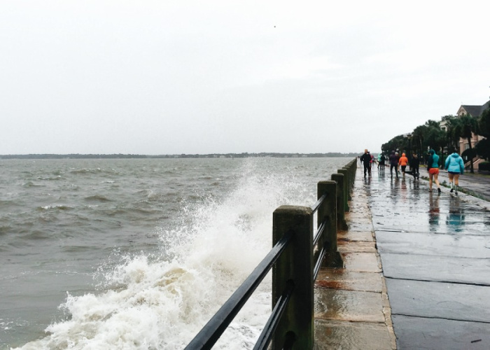
 A flooded road in Charleston 1.5 hours after high tide.
 Typically falling during a full or new moon, king tides can can disrupt or delay commutes and damage our homes and neighborhoods. This year alone, we’re anticipating 32 days of king tides, 23 of which are set to take place during hurricane season.
So, what happens when an impending hurricane (and its subsequent storm surge) hits around the same time as a king tide? Our coastal communities could come face-to-face with a wall of incoming water taller than a one-story building.
Take Hurricane Hugo, for example. When this storm made landfall nearly 33 years ago, it brought a storm surge of 12-foot waves along with it. What if a hurricane of that magnitude hit during an 8-foot king tide, in conjunction with ever-rising sea levels? That’s a 21-foot tide setting its sights on the Holy City.
One way we can understand the magnitude of these scenarios and strategize resilience plans for the future is by having enough data to drive decisions.
Charting a Course for a More Resilient Coast
Did you know we have a tool available for you to see how sea level rise will affect your home, work and community? Just type your address into this interactive tool and use the map to simulate potential impact to your area. Dive deeper into what sea rise means for your community through our environmental and population overlays. You can even see how sea turtle nesting grounds along the South Carolina coast will be impacted.
 Scenario showing sea rise of 2 feet for downtown Charleston.
In the South Carolina Aquarium Citizen Science app (located in the App store or on Google Play), the Sea Rise Project allows users to upload photos of flooding and related impacts through South Carolina, as well as measure and report the depth of flood waters (under safe conditions).
As the eyes and ears throughout the state, living on the frontlines and facing the effects of sunny day flooding and more, your firsthand accounts can drive actionable change. You can become a citizen scientist by utilizing the Sea Rise Project in the app and contributing to crowd-sourced data.
With your help along the way, we can turn the tide and chart a course for a more resilient coast.
Published June 8, 2022